
On Northwestern Outdoor Radio
Presently, I am out in the field for a special research project involving Wolverines, but I wanted to share this clip from this week's Northwestern Outdoors Radio show.
I was interviewed by John Kruse, host of the show, to talk about two things:
- Elk photography and my free e-book on wildlife photography.
- My thoughts on the work that the Wilderness Society is doing to protect and promote our wild public lands, as well as my role in the #OurWild Campaign.
It was a pleasure doing the interview and I hope you enjoy it!
Montana Nature Photographer Tony Bynum and Science Teacher Stacy Dolderer Dive Deep into the Montana Prairie in Search of Wilderness Characteristics
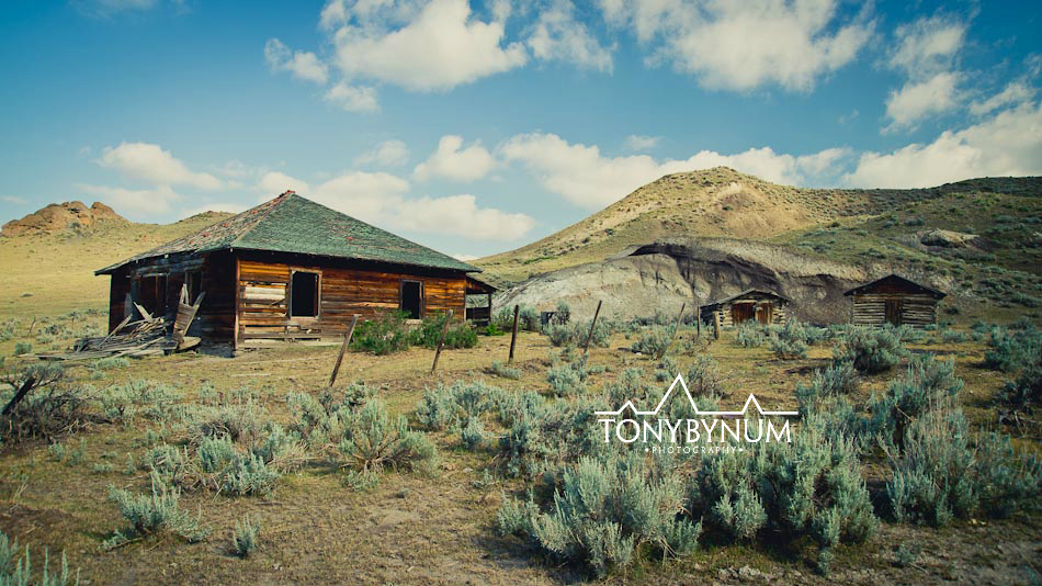
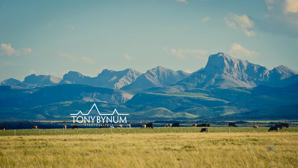
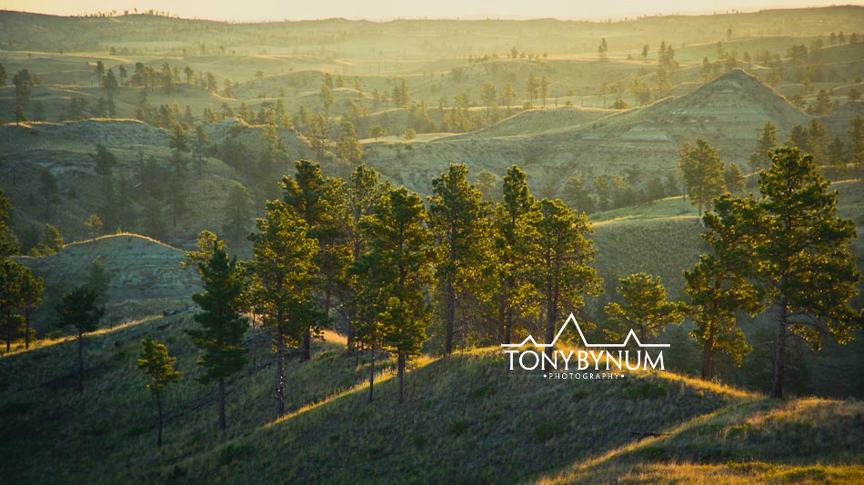
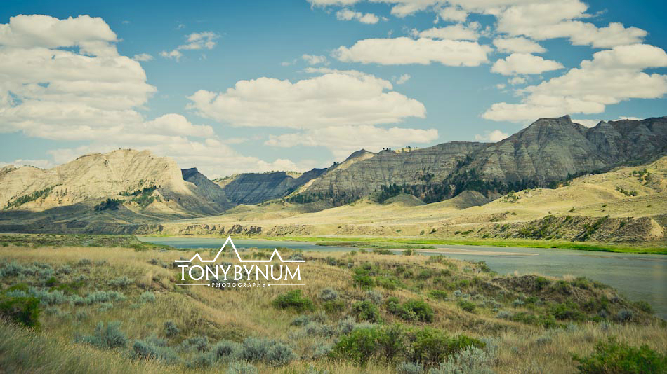
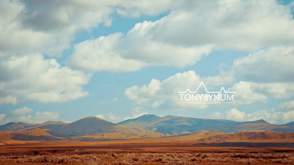
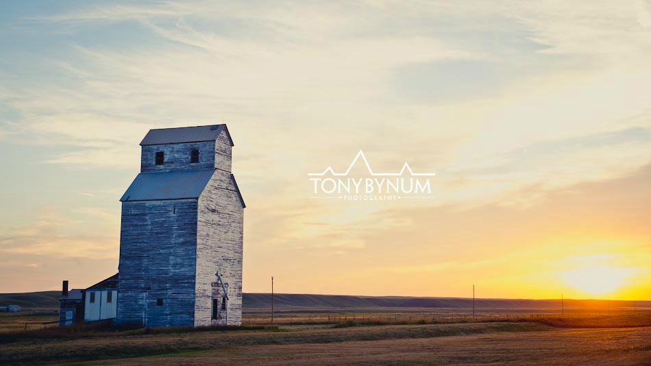
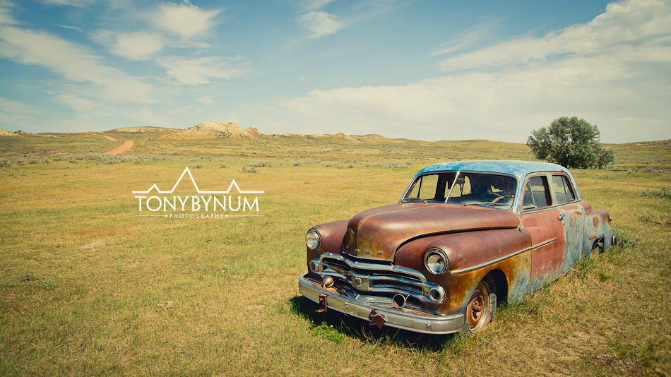
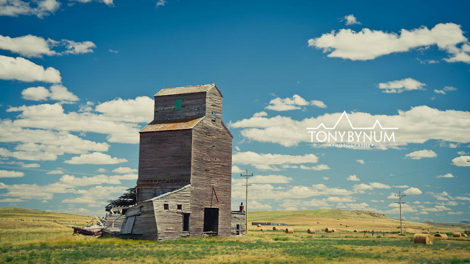
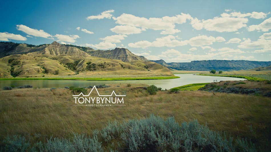
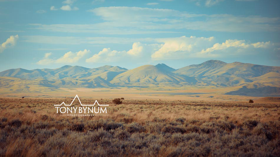
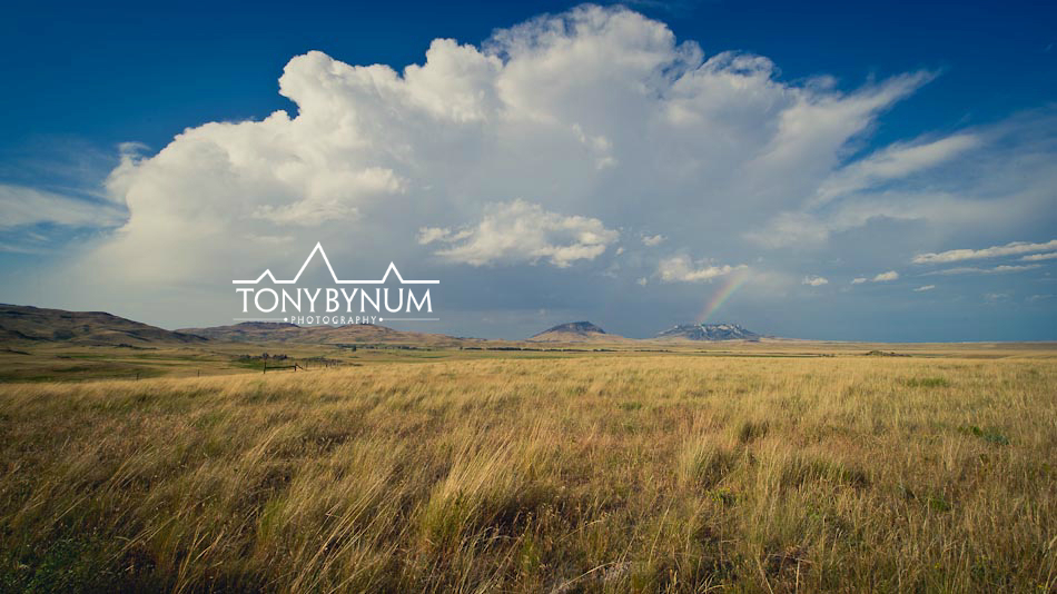
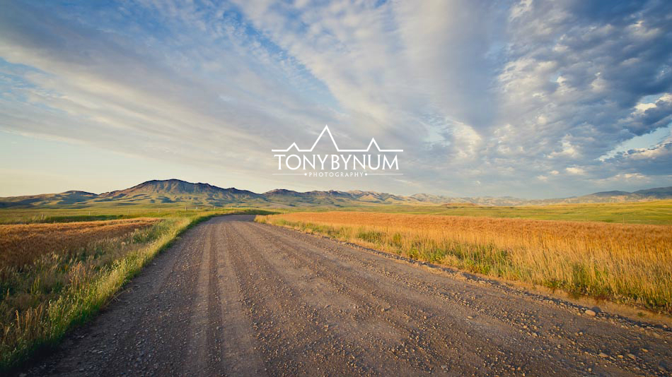
When Erin Madison, (@GFT_EMadison) outdoor writer for the Great Falls Tribune (@GFTribue) called us to do an interview about the Montana prairie project we worked on recently, we were happy to say yes! As many of you know, my partner Stacy Dolderer and I spent several months bouncing around the prairie lands of Montana last summer. It may not sound like much to most of you, but taking on the challenge of inventorying millions of acres of public lands to find areas that contain wilderness characteristics was to us, an awesome opportunity. Could there be a better project for a full time outdoor, nature, wildlife, and adventure photographer, and Stacy, a science teacher, to undertake? Why we did it, and what we found is contained in this great piece by, Erin Madison, titled (link to full article) "Beautiful in it's own way: Photographer, teacher spend a month recording Eastern Montana wonders." Here are some additional Montana photographs captured by Tony Bynum along the way.
I hope you enjoy the read as much as we did telling the story!
Tony Bynum and Stacy Dolderer
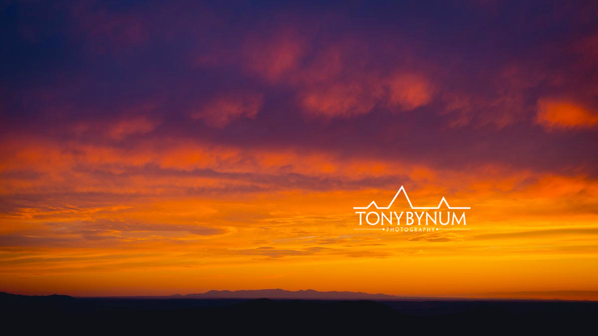
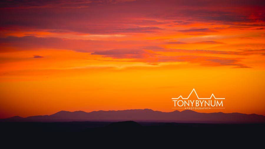
Montana Prairie - it's not all just flat, dry, BLM land
Montana Quarterly Magazine features an essay by award winning author Scott Mcmillion about an important prairie conservation project conducted in the wild prairie lands of Montana . . . One of the most rewarding and fun projects I've ever had the privilege to work on . . . Stacy Dolderer and I had a great time exploring places few people ever get to see . . .
I'm taking this show on the road later this winter and into the spring. I'll be speaking in Missoula, Bozeman, Helena, Havre, and Billings . . . Stay tuned for dates, time's and locations!
Have a Merry Christmas!
Tony Bynum
@tonybynum
Lands with Wilderness Characteristics - Montana Short Grass Prairie - roads, ways, routes? Who cares . . .
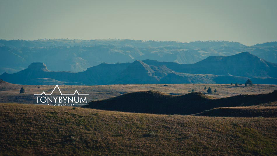
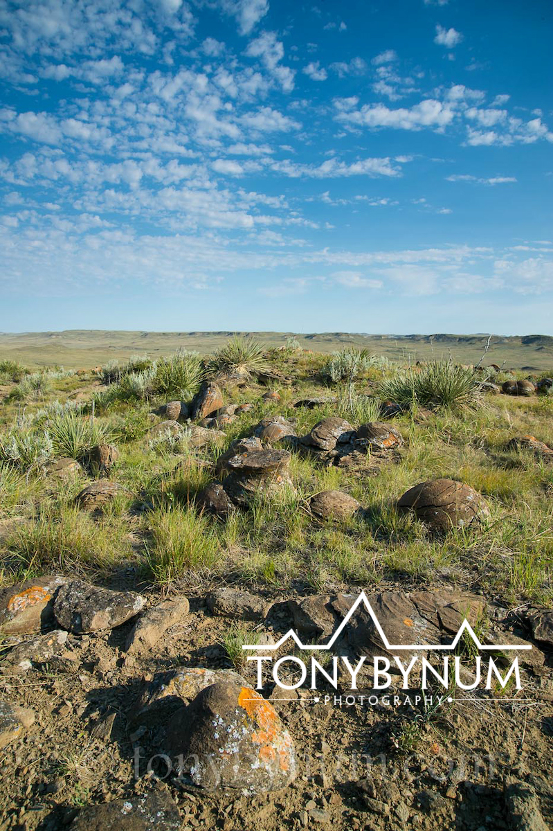
Greetings! It's been while since my last post, I'm sorry for the delay, we've been out trekking though the last of Montana's native, short grass prairie lands south and west of Glasgow, Montana. We covered 1500 miles over the course of that week exploring the vast network of roads, ways, trails, and routs. Along the trail, we met some great people like the gas station owners in Saco, MT and a ranching couple that live 70 miles from the nearest store. We explored some fantastic, wild prairie and badlands, and had a lot of fun along the way! As you know, we're out looking for and photographing lands with "wilderness characteristics." The Bureau of Land Management (BLM) is responsible for inventorying the public lands under its jurisdiction for their wilderness characteristics. Basically any area with 5,000 acres or more can contain areas with wilderness character. Now surely not all areas qualify, but 5,000 acres, unless it's a truly unusual land form, is the minimum area that can qualify. Roads and property ownership define the boundary's of each area. The presence or absence of roads, and the area's solitude along with its opportunities for primitive recreation are additional attributes the BLM uses when inventorying its lands for wilderness character. The BLM, is required to keep an inventory of all of it's lands and resources, including those with wilderness character.

We've learned after talking with a few BLM folks, that defining what's a road and what's a, "way" as it relates to wilderness characteristics inventory, is not as simple as the legal definition of a road make it sound. Without getting much further into the weeds, lets just say that we've found that most of what are being called roads in this area are really "ways" -- user created and maintained by vehicle traffic mostly during the fall and almost all associated with hunting -- and do not, therefore, in our estimation meet the definition of a road. The BLM uses the definition of a road found in the federal lands policy and management act and defines a road, for the purposes of wilderness characteristics inventory in this way,
"roads [are road] which have been improved and maintained by mechanical means to insure relatively regular and continuous use. A way maintained solely by the passage of vehicles does not constitute a road" (guidance: "wilderness characteristics inventory," manual 6301, page 15, February 25, 2011). As of March 2012, BLM is operating under the new, final manual 6310, "Conducting Wilderness Inventory on BLM Lands." (3/15/2012).
As this video will show, the area along the route, that's before the dry creek crossing looks to us more like a "way," than a "maintained by mechanical means to insure relatively regular and continuous use." The video is sped up to turn a 40 minute ride into a 4 minute one.
In most places along these and other routes, there is no evidence that the BLM has ever mechanically maintained them. Mainly there is evidence that "continuous" means a few times per year, and it is almost impossible to find, beyond the few main county roads, routs that are mechanically maintained or continuously used.

Leaving behind that issues for awhile, we would be remiss if we failed to mention the amount of sincere respect and admiration we have for the people who live and work in this harsh yet spectacular landscape. It is wild and dry, with hard bentonite soil that can be as unforgiving when wet as it is when dry. The farmers and ranchers are challenged with knowing when to drive on which roads, when that perfect time is to sew the seeds, harvest and work the land, and how to move the cattle through the numerous drainages.
We have also found that our presence in the area was cause for local concern. While the project we are completing is in the public interest, and on public land, many of the people think we are out to designate more wilderness areas (read about the issues with this and other conservation projects in this region), but we're not, that's a job for Congress; we are out inventorying the land in search of areas with wilderness characteristics in the same way that the BLM is required by law to do.
In fact, the BLM has just completed it's own surveys of lands with wilderness characteristics and it will explain what it found later this fall when three Resource Management Plans are released for public review and comment; the draft Hi-line, Draft Miles City, and Draft Billings area Resources Management Plans. In one case we were flatly denied access to BLM across a piece of private land because we were specifically looking at that area for it's wilderness characteristics. The people who denied us access lease the land for grazing and are very much afraid that the government is going to kick them off their land and turn the area into a national park. . . I'm not making this up. There were other's who voiced similar concerns.
Much of this area also borders the Charles M Russell Wildlife Area, or "CMR." This area is prime habitat for elk, big-horn sheep, mule deer, and antelope. However, we have seen almost no pronghorn, mule deer, or whitetail despite this being prime habitat. The antelope and whitetail deer suffered almost a 95% die-off during the winter of 2010-11 due to record snow. So much snow that the only way the animals could move around was to use the rail-road tracks. Hundreds of pronghorn (antelope) were killed at a time when the trains came through. Still more fled the deep snow south across the frozen Fort Peck Lake and were unable to return in the spring when the ice thawed - some even drowned attempting to return to this area. Later that spring, the whitetail deer suffered a disease which devastated their numbers. The loss is evident as we have seen only a handful of pronghorn or deer when historically we'd have seeing hundreds a day.
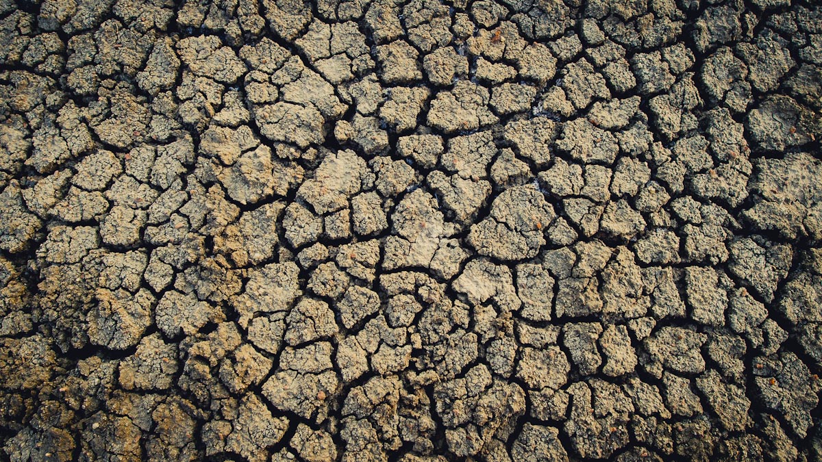
Bentonite . . . what is it? Bentonite is the dark, hard, cracking, dry soil that comprises much of this landscape. As I look over the area much of it is bentonite bad-lands, some flat, some steep sided, but all clay! Bentonite is clay. We passed an abandoned bentonite mine that we were told produced one rail car load before closing down. This soil, if you can call it that, is tough when dry, and clay-like when wet. It can absorb as much as several times its dry mass in water and makes a perfect seal when wet. It is used in products such as kitty-litter as well as for the lining of bore holes for drilling wells.
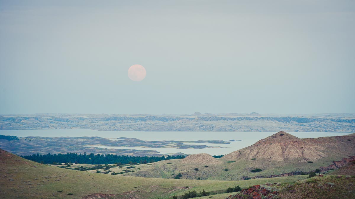
We experienced firsthand the power of this substance when we sunk to the axle while trying to cross a creek bed we were sure was dry. It took us upwards of 2 hours digging the clay by hand out from under the front axle to get us out. As we were working there was a perfect sunset and full moon rising that we missed…of course. I also can’t believe we didn't get a photo of the whole ordeal. All we have left is the clay caked shoes, clothes, and clumps of bentonite forever be stuck to the underside of the rig.
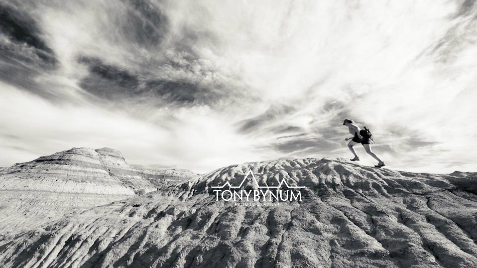
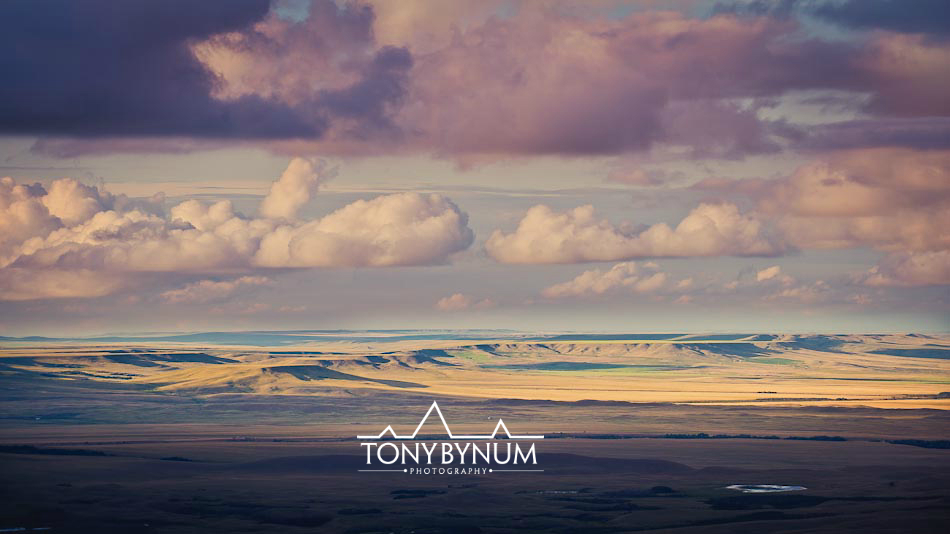
This is the image I captured the following evening. . . It's a bit flat, due to haze and clouds, but the softness of it adds a warm, inviting aspect that often we miss as landscape photographers.
We now are home for a few days to catch up and start working on our reports and maps. Anyone know ArcMap? Ugh! Stacy's brain is being put to the full test. Next stop, the Mussel Shell, Ekalaka, and then back to the short grass prairie area! We can’t wait!
If you'd like to follow along on this prairie adventure be sure to add your name by signing up - upper right hand corner there's a link - or follow us on facebook . . . http://www.facebook.com/tony.bynum
Tony Bynum